In partnership with: 
|
December 8, 2012 at 7:43 am |
|
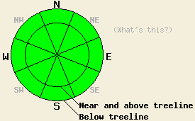
Avalanche danger is LOW for all elevations and aspects. Normal caution is advised. Long, unarrested sliding falls down icy slopes leading to impact with trees or rocks is likely the greatest hazard in the backcountry today. |
|
|
|
A weather system passing to the north and east of the forecast area today will bring increasing thin high cloud cover and moderate speed winds. Ridgetop winds will maintain a northerly component, shifting from northwest to northeast and gradually increasing today, tonight and tomorrow. An air temperature inversion is in place this morning with air temperatures on the mountain valley floors in the mid 20s and air temperatures above 6,500' in the upper 20s to mid 30s. Maximum daytime air temperatures are forecast to warm into the mid 30s to mid 40s today for most elevations. Around 5 degrees of cooling is expected for tomorrow versus today.
Observations made yesterday on Relay Peak (Mount Rose area) and on Mt. Judah (Donner Summit area) revealed more firm crusts with some softening on south aspects during the early afternoon hours. This matched well with other recent observations from Mt. Tallac (Desolation Wilderness area), Rubicon Peak (West Shore Tahoe area), and Tamarack Peak (Mount Rose area). Supportable rain crust exists on all aspects below 9,200' and extends to above 10,000' in some areas. Deeper in the snowpack, rain wetted layers that are in a slow process of refreezing have shown no evidence of snowpack instability. Near crust facet formation has started to occur between the top two rain crusts in the snowpack. This was just beginning to show in the very early stages yesterday on Mt. Judah and was much more well developed on Relay Peak (photos, pit profiles, more info).
Avalanche Concerns:
Avalanche concerns for today are few. A frozen/refreezing icy snowpack displaying a widespread lack of instability combined with minimal solar radiation at this time of year will keep avalanche activity unlikely today. A short window of snow surface melting is expected today on southerly aspects, but not enough to cause any concerns for wet loose or wet slab avalanches. Little to no snow is available for wind transport, so new wind slab formation is unlikely today despite increasing NW to NE winds. The faceting that is occurring between the top two rain crusts in the snowpack is not an instability concern for today, but something to keep an eye on as future loading occurs. Long, unarrested sliding falls down icy slopes leading to impact with trees or rocks is likely the greatest hazard in the backcountry today.
Avalanche danger is LOW for all elevations and aspects. Normal caution is advised. Long, unarrested sliding falls down icy slopes leading to impact with trees or rocks is likely the greatest hazard in the backcountry today.
| 0600 temperature: | 29 to 35 deg. F. |
| Max. temperature in the last 24 hours: | 38 to 42 deg. F. |
| Average wind direction during the last 24 hours: | Northeast shifting to west |
| Average wind speed during the last 24 hours: | 18 mph |
| Maximum wind gust in the last 24 hours: | 29 mph |
| New snowfall in the last 24 hours: | O inches |
| Total snow depth: | 34 to 47 inches |
For 7000-8000 ft: |
|||
| Saturday: | Saturday Night: | Sunday: | |
| Weather: | Thin high cloud cover. | Mostly cloudy skies, becoming partly cloudy. | Sunny skies. |
| Temperatures: | 38 to 45 deg. F. | 25 to 32 deg. F. | 33 to 39 deg. F. |
| Wind direction: | W shifting to N in the afternoon. | NE | NE |
| Wind speed: | 10 to 15 mph with gusts to 25 mph. | 15 to 20 mph with gusts to 30 mph. | 20 to 30 mph with gusts to 40 mph. |
| Expected snowfall: | O in. | O in. | O in. |
For 8000-9000 ft: |
|||
| Saturday: | Saturday Night: | Sunday: | |
| Weather: | Thin high cloud cover. | Mostly cloudy skies, becoming partly cloudy. | Sunny skies. |
| Temperatures: | 32 to 39 deg. F. | 25 to 32 deg. F. | 30 to 35 deg. F. |
| Wind direction: | NW | NE | NE |
| Wind speed: | 20 to 30 mph with gusts to 45 mph. | 25 to 35 mph with gusts to 55 mph. | 35 to 45 mph with gusts to 65 mph. |
| Expected snowfall: | O in. | O in. | O in. |


This website is owned and maintained by the non-profit arm of the Sierra Avalanche Center. Some of the content is updated by the USDA avalanche forecasters including the forecasts and some observational data. The USDA is not responsible for any advertising, fund-raising events/information, or sponsorship information, or other content not related to the forecasts and the data pertaining to the forecasts.

