In partnership with: 
|
January 5, 2013 at 7:52 am |
|
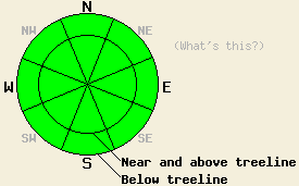
Avalanche danger remains LOW for all elevations and aspects. During LOW danger avalanches are unlikely but not impossible. Areas of unstable snow might exist on isolated terrain features. Continue to use normal caution when travelling in the backcountry. |
|
|
|
A temperature inversion exists across the forecast area again this morning with temperatures above 7000 ft. much warmer than those in the mountain valleys. The high pressure ridge over the region should keep the weather mostly clear and dry again today. This high pressure should begin to move out of the area today. The winds and cloud cover should increase this afternoon ahead of a low pressure system forecasted to hit the forecast area tonight. Even though this system should split causing most of its energy to go around the Tahoe region, the forecast calls for this low pressure to bring strong southwest winds and some snow to the area. Along the Sierra Crest 2-7 inches could accumulate by tomorrow afternoon before the storm departs. Areas south of Hwy 50 should see the largest accumulations.
On Maggies Peak (more info), near Stanford Rocks (video, photos, more info), and in the Mt. Rose Wilderness (photos, snowpit, more info) yesterday, observations and data continued to point to a strong and stable upper snowpack with a wide variety of surface conditions. These included soft unconsolidated snow on sheltered NW-N-NE aspects, wind scoured and wind buffed surfaces on exposed near and above treeline slopes, and thin breakable sun crusts that melted into wet sticky snow on sun-exposed E-SE-S-SW aspects. Patches of surface hoar had also formed in some of the more sheltered below treeline areas. Ski cuts on test slopes, handpits, snowpit data, and general observations did not reveal any signs of significant instability within the upper snowpack yesterday.
Over the last several days, data regarding the Dec. facet layers has shown that these deeper persistent weak layers remain weak. The data also indicates that transmitting enough force through the snowpack to actually break these layers has become more difficult due to the strong snow above these old weaknesses. If they do start to collapse, the resulting fracture could travel along the weak layer.
Snowpack Concerns: Wind Slabs and Persistent Deep Slabs
On a regional scale, avalanche activity caused by a single skier, snowboarder, or snowmobiler remains unlikely. Some areas of unstable snow could still lurk in complex or extreme terrain in and around steep chutes, gullies, couloirs, cliffs and rock bands especially in wind loaded areas. The deeply buried persistent weak layers have become dormant due to the strong snow on above them that insulates those layers from forces applied to the snow surface. Triggering persistent deep slabs has become unlikely for this reason. Triggers larger than a single person recreating on a slope such as multiple people close together on the same slope, very large cornice collapses, or other avalanches might still provide the force needed to cause a deep slab failure. If such a failure does occur, avalanches with catastrophic consequences would result.
Continue to exercise good travel techniques like moving one at time from safe zone to safe zone while in avalanche terrain. Soft snow and a sense of stability can easily impair judgment and create unsafe situations.
Avalanche danger remains LOW for all elevations and aspects. During LOW danger avalanches are unlikely but not impossible. Areas of unstable snow might exist on isolated terrain features. Continue to use normal caution when travelling in the backcountry.
| 0600 temperature: | 25-33 deg. F. |
| Max. temperature in the last 24 hours: | 37-43 deg. F. |
| Average wind direction during the last 24 hours: | Southwest |
| Average wind speed during the last 24 hours: | 10-20 mph |
| Maximum wind gust in the last 24 hours: | 36 mph |
| New snowfall in the last 24 hours: | O inches |
| Total snow depth: | 60-86 inches |
For 7000-8000 ft: |
|||
| Saturday: | Saturday Night: | Sunday: | |
| Weather: | Partly cloudy becoming mostly cloudy later in the day | Cloudy with a chance of snow in the evening. Snow becoming likely after midnight. | Snow |
| Temperatures: | 35-42 deg. F. | 11-18 deg. F. | 19-26 deg. F. |
| Wind direction: | Southwest | Southwest | Southwest |
| Wind speed: | 15-20 mph with gusts to 30 mph increasing to 35-40 mph with gusts to 60 mph in the afternoon | 35-40 mph with gusts to 60 mph decreasing to 25-30 mph with gusts to 40 mph after midnight | 20-30 mph with gusts up to 40 mph |
| Expected snowfall: | O in. | up to 2 in. | 2-3 in. |
For 8000-9000 ft: |
|||
| Saturday: | Saturday Night: | Sunday: | |
| Weather: | Partly cloudy becoming mostly cloudy later in the day | Cloudy with a chance of snow in the evening. Snow becoming likely after midnight. | Snow |
| Temperatures: | 31-38 deg. F. | 7-14 deg. F. | 13-20 deg. F. |
| Wind direction: | Southwest | Southwest | Southwest shifting to west in the afternoon |
| Wind speed: | 20-25 mph with gusts to 35 mph increasing to 40-45 mph with gusts to 65 mph in the afternoon | 35-45 mph with gusts to 65 mph | 35-40 mph with gusts to 60 mph decreasing to 25-30 mph with gusts to 45 mph in the afternoon |
| Expected snowfall: | O in. | up to 2 in. | 2-5 in. |


This website is owned and maintained by the non-profit arm of the Sierra Avalanche Center. Some of the content is updated by the USDA avalanche forecasters including the forecasts and some observational data. The USDA is not responsible for any advertising, fund-raising events/information, or sponsorship information, or other content not related to the forecasts and the data pertaining to the forecasts.

