In partnership with: 
|
February 12, 2013 at 7:45 am |
|
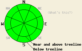
Avalanche danger is LOW for all elevations and aspects. Isolated areas of unstable hard wind slabs may exist in recently wind loaded areas near and above treeline. Normal caution is advised. |
|
|
|
High pressure to the west of the forecast area will slowly move further into the region over the next few days. As a result, ridgetop winds are decreasing in speed and maximum daytime air temperatures are on a warming trend. Ridgetop winds out of the northeast steadily decreased from strong in speed early yesterday morning to light in speed this morning. Light northeast winds are forecast to continue today. Air temperatures above 8,000' are in the upper teens to mid 20s this morning and are forecast to warm into the upper 20s to low 30s today. Maximum daytime air temperatures for tomorrow are forecast at 5 degrees warmer than today with light winds expected.
Observations made yesterday on the south side of Carpenter Ridge (Independence Lake area) revealed new wind slabs up around 9 inches thick in lee areas on SE-S-SW aspects. These slabs sat on top of a thin layer of lower density storm snow. Snowpit tests revealed that these slabs were difficult to trigger and unlikely to propagate once triggered. No cracking or other signs of instability were observed while traveling over wind slabs near and along the ridgetop in this area (photo, more info).
Observations made on the north side of Carpenter Ridge and on north aspects in the Deep Creek Drainage (Deep Creek/Pole Creek area) matched well with other recent observations on northerly aspects around the forecast area. Near surface and near crust faceting processes continue to act on the the top 1 foot or so of the snowpack in these areas. Up to a couple inches or so of recent storm snow exists on top of mostly supportable rain crust with softer faceted snow below. With no significant load above these weak layers, the snowpack is currently stable in these areas that lack surface wind slabs (pit profile, more info).
Avalanche Problem #1: Wind Slabs
Recent northeast winds scoured snow from near and above treeline areas on N-NE-E aspects and deposited it into lee areas on SE-S-SW-W-NW aspects. These hard slabs have shown evidence of stability in limited observations yesterday. Slab size is generally less than 1 foot deep and focused close to ridgelines or other terrain features that created a lee area for deposition. These slabs are expected to remain stable today with human triggering unlikely. Isolated areas of instability may exist, especially in areas of complex or extreme terrain.
Avalanche danger is LOW for all elevations and aspects. Isolated areas of unstable hard wind slabs may exist in recently wind loaded areas near and above treeline. Normal caution is advised.
| 0600 temperature: | 18 to 25 deg. F. |
| Max. temperature in the last 24 hours: | 24 to 33 deg. F. |
| Average wind direction during the last 24 hours: | Northeast |
| Average wind speed during the last 24 hours: | 22 mph |
| Maximum wind gust in the last 24 hours: | 41 mph |
| New snowfall in the last 24 hours: | O inches |
| Total snow depth: | 57 to 80 inches |
For 7000-8000 ft: |
|||
| Tuesday: | Tuesday Night: | Wednesday: | |
| Weather: | Mostly sunny skies. | Clear skies. | Sunny skies. |
| Temperatures: | 31 to 38 deg. F. | 20 to 28 deg. F. | 35 to 42 deg. F. |
| Wind direction: | NE | Variable | Variable |
| Wind speed: | 10 to 15 mph in the morning, becoming light. | Light winds | Light winds |
| Expected snowfall: | O in. | O in. | O in. |
For 8000-9000 ft: |
|||
| Tuesday: | Tuesday Night: | Wednesday: | |
| Weather: | Mostly sunny skies. | Clear skies. | Sunny skies. |
| Temperatures: | 26 to 33 deg. F. | 22 to 28 deg. F. | 31 to 38 deg. F. |
| Wind direction: | NE | N | N |
| Wind speed: | 10 to 15 mph. Gusts up to 25 mph in the morning. | 10 to 15 mph. | 10 to 15 mph with gusts to 25 mph in the morning, becoming light. |
| Expected snowfall: | O in. | O in. | O in. |


This website is owned and maintained by the non-profit arm of the Sierra Avalanche Center. Some of the content is updated by the USDA avalanche forecasters including the forecasts and some observational data. The USDA is not responsible for any advertising, fund-raising events/information, or sponsorship information, or other content not related to the forecasts and the data pertaining to the forecasts.

