In partnership with: 
|
February 15, 2013 at 7:52 am |
|
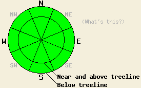
The avalanche danger remains LOW for all elevations and aspects. Continue to use normal caution when traveling in the backcountry. |
|
|
|
The high pressure ridge over the west coast will allow the clear sunny weather to continue through the weekend. The east winds that have remained stubbornly strong for the last several days should finally begin to decrease this afternoon. As the ridge moves slowly eastward over the area, the wind should shift towards the south and west tonight and tomorrow. Temperatures today and tomorrow should climb into the upper 30's and low 40's above 7000 ft.
Conditions similar to those on Red Lake Peak existed yesterday on Castle Peak (snowpit, more info). 2-4 inches of soft corn snow formed on S-SE aspects in areas sheltered from the strong east winds. In areas exposed to the strong east winds the snow surface remained mostly frozen even on the sunny southerly aspects. Below the surface on these southerly aspects a thick layer of firm melt freeze snow exists. The snow surface on the open and exposed NW-N-NE-E aspects in this area consisted of old scoured crusts and firm wind packed surfaces. On sheltered northerly aspects on Castle Peak, some soft unconsolidated snow remains on top of the crusts. Below these crusts a layer of weak sugary snow (facets) does exist. Tests on this layer indicated that if this layer breaks, the resulting fracture should not travel very far.
Avalanche Concerns:
Avalanche activity will remain unlikely. More sunshine and warm air temperatures should allow soft wet corn snow to form on some of the sun exposed SE-S-SW aspects today. The continued strong east winds should prevent widespread pervasive melting and softening again today. These winds may again keep some of the more exposed SE-S-SW aspects frozen. In the unlikely event that wet snow instabilities do form today, they should remain limited to small roller balls and small isolated point releases.
The avalanche danger remains LOW for all elevations and aspects. Continue to use normal caution when traveling in the backcountry.
| 0600 temperature: | 24-32 deg. F. |
| Max. temperature in the last 24 hours: | 32-42 deg. F. |
| Average wind direction during the last 24 hours: | East |
| Average wind speed during the last 24 hours: | 25-35 mph |
| Maximum wind gust in the last 24 hours: | 47-59 mph |
| New snowfall in the last 24 hours: | O inches |
| Total snow depth: | 55-80 inches |
For 7000-8000 ft: |
|||
| Friday: | Friday Night: | Saturday: | |
| Weather: | Sunny | Clear | Sunny |
| Temperatures: | 38-46 deg. F. | 25-33 deg. F. | 39-47 deg. F. |
| Wind direction: | East | South | West |
| Wind speed: | 25-30 mph with gusts to 45 mph decreasing to 10-15 mph in the afternoon | Light increasing to 10-15 mph after midnight | 15-20 mph with gusts to 30 mph |
| Expected snowfall: | O in. | O in. | O in. |
For 8000-9000 ft: |
|||
| Friday: | Friday Night: | Saturday: | |
| Weather: | Sunny | Clear | Sunny |
| Temperatures: | 35-42 deg. F. | 23-31 deg. F. | 34-41 deg. F. |
| Wind direction: | East | South | West |
| Wind speed: | 30-35 mph with gusts to 50 mph decreasing to 10-15 mph with gusts to 30 mph in the afternoon | 15-20 mph with gusts to 30 mph | 20-30 mph with gusts to 45 mph |
| Expected snowfall: | O in. | O in. | O in. |


This website is owned and maintained by the non-profit arm of the Sierra Avalanche Center. Some of the content is updated by the USDA avalanche forecasters including the forecasts and some observational data. The USDA is not responsible for any advertising, fund-raising events/information, or sponsorship information, or other content not related to the forecasts and the data pertaining to the forecasts.

