In partnership with: 
|
February 18, 2013 at 7:55 am |
|
Avalanche danger remains LOW for all elevations and aspects. Avalanche danger will increase beginning early Tuesday morning. |
|
|
|
Transitional weather will occur today as a major pattern change occurs and the first of several storm systems approaches the forecast area. For today, expect increasing cloud cover and increasing southwest winds ahead of the approaching weather system. Ridgetop winds are moderate in speed this morning but will increase to strong to gale force in speed this afternoon and tonight. A strong cold front will move through the area decreasing maximum daytime air temperatures by 15 degrees tomorrow as compared to today. Light snowfall with little to no accumulation is possible this evening and overnight. More significant snowfall is forecast to begin early tomorrow morning. There remains significant uncertainty in snowfall amounts for Tuesday with model solutions indicating new snow amounts of anywhere from 4 to 14 inches.
Observations made yesterday on Silver Peak (Pole Creek area) and in the Mt. Reba/Horse Canyon area near Bear Valley continue to indicate good to very good snowpack stability (pit profile, videos, more info). Stable but faceted snow layers are widespread on northerly aspects within the top 1 foot of the snowpack. For the most part these layers are in decent condition to handle new snow loading. With a few isolated exceptions of shallow snowpack areas in the Carson Range, propagation tests targeting these faceted weak layers have pointed to propagation as unlikely in the event of weak layer collapse under future snow loading conditions (info on observed exceptions here and here). In some areas, near surface faceted snow crystals and patchy surface hoar exist on northerly aspects in near treeline and below treeline terrain. These thin weak layers sit on top of smooth rain crust. This weak layer and bed surface combo could contribute to instability at or just below the old/new snow interface as the upcoming storm cycle progresses.
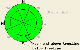
Avalanche Concerns:
Natural and human triggered avalanches remain unlikely today. A small amount of wet surface snow may form today in wind protected areas on low and mid elevation SE-S-SW aspects. Other areas that have undergone melt-freeze cycles in recent days may remain frozen all day today due to convection cooling of the snow surface from wind and overall colder air temperatures as compared to the past few days. Any form of wet snow instability is unlikely today. Slab avalanche activity will remain unlikely until after the onset of snowfall. Looking to Tuesday, avalanche problems of wind slabs and storm slabs are expected to develop.
Avalanche danger remains LOW for all elevations and aspects. Avalanche danger will increase beginning early Tuesday morning.
| 0600 temperature: | 24 to 30 deg. F. |
| Max. temperature in the last 24 hours: | 36 to 43 deg. F. |
| Average wind direction during the last 24 hours: | Southwest |
| Average wind speed during the last 24 hours: | 20 mph |
| Maximum wind gust in the last 24 hours: | 32 mph |
| New snowfall in the last 24 hours: | O inches |
| Total snow depth: | 53 to 78 inches |
For 7000-8000 ft: |
|||
| Monday: | Monday Night: | Tuesday: | |
| Weather: | Mid to high level cloud cover creating partly to mostly cloudy skies. | Cloudy skies with a slight chance of snow showers in the evening. A chance of snow showers after midnight. | Cloudy skies with snow. |
| Temperatures: | 34 to 40 deg. F. | 15 to 21 deg. F. | 18 to 24 deg. F. |
| Wind direction: | SW | SW | SW |
| Wind speed: | Light winds increasing to 20 to 25 mph with gusts to 40 mph in the afternoon. | 30 to 40 mph. Gusts to 50 mph increasing to 60 mph after midnight. | 35 to 40 mph with gusts to 60 mph, decreasing to 25 to 30 mph with gusts to 45 mph in the afternoon. |
| Expected snowfall: | O in. | 0 to 1 in. | 5 to 8 in. |
For 8000-9000 ft: |
|||
| Monday: | Monday Night: | Tuesday: | |
| Weather: | Mid to high level cloud cover creating partly to mostly cloudy skies. | Cloudy skies with a slight chance of snow showers in the evening. A chance of snow showers after midnight. | Cloudy skies with snow. |
| Temperatures: | 29 to 34 deg. F. | 12 to 18 deg. F. | 14 to 18 deg. F. |
| Wind direction: | SW | SW | SW |
| Wind speed: | 20 to 25 mph with gusts to 40 mph, increasing to 35 to 40 mph with gusts to 60 mph in the afternoon. | 35 to 40 mph with gusts to 60 mph, increasing to 45 to 50 mph with gusts to 80 mph after midnight. | 55 to 60 mph with gusts to 90 mph, decreasing to 45 to 50 mph with gusts to 75 mph in the afternoon. |
| Expected snowfall: | O in. | 0 to 1 in. | 6 to 10 in. |


This website is owned and maintained by the non-profit arm of the Sierra Avalanche Center. Some of the content is updated by the USDA avalanche forecasters including the forecasts and some observational data. The USDA is not responsible for any advertising, fund-raising events/information, or sponsorship information, or other content not related to the forecasts and the data pertaining to the forecasts.

