In partnership with: 
|
February 26, 2013 at 8:00 am |
|
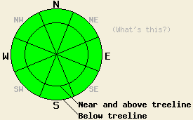
On a regional scale the avalanche danger remains LOW for all elevations and aspects. Finding an isolated unstable wind slab is unlikely but not impossible today in near treeline or above treeline terrain. Continue to use normal caution when traveling in the backcountry. |
|
|
|
A high pressure ridge over the region will keep the weather dry and sunny today. The north and east winds should continue today, but they should decrease over the next 24 hours. By tomorrow the winds should shift back to the west and become light. Today's northerly flow should keep daytime highs in the mid to upper 30's today. The forecast calls for gradual warming over the next few days as the high pressure ridge strengthens.
On Incline Lake Peak (snowpit, more info) yesterday, small hard wind slabs remained on near and above treeline NW-N-NE and S-SW-W aspects. Most of these wind slabs extended down slope less than 10 ft and measured less than 10 ft wide. Their depth ranged form 2-6 inches on the northerly aspects to 2-3 ft in one spot on a small SW facing test slope. Snowpit tests on the SW facing test slope showed that fractures could propagate along a thin layer of weak snow resting on a crust at the base of the wind slab. However, ski cuts and aggressively weighting the test slope did not produce any cracks or other signs of instability even on the edge of the snowpit. On the northerly aspects the majority of observations and tests showed stable results. Another party reported a large shooting crack accompanied by a collapse on a wind-loaded N facing slope on Donner Peak. This collapse occurred while several people were standing on the slope. Other observations around the forecast area have shown similar hard wind slabs that remain difficult to trigger on all near and above treeline aspects.
Below treeline in sheltered areas, 2-5 inches of soft snow existed above a rain crust on the northerly aspects on Incline Lake Peak yesterday. Snowpit data showed that this rain crusts continues to erode and that a layer of weak sugary snow (facets) does exist below the crust. Tests on that facet layer indicated that if it breaks, fractures should not travel very far.
Avalanche Problem #1: Wind Slabs
The strong shifting winds that occurred during and after last week's snowfall, created hard stubborn wind slabs on most aspects near ridgelines in near and above treeline terrain. These wind slabs remain relatively small and do not extend very far down slope due to the lack of snow available to construct larger slabs. Some tests on these slabs have indicated that they remain unstable; however, most of the data indicates that they have become difficult for a single person to trigger. Triggering one of these slabs remains unlikely on a regional scale. Finding a slope or two where a person could trigger one of these small slabs is not impossible. Isolated wind loaded or cross loaded complex or extreme terrain near the Sierra Crest represents the best terrain to find one of these small isolated and more fragile wind slabs.
Avalanche Problem #2: Loose Wet Snow
Sunshine, decreased winds, and slightly warmer temperatures may allow some small roller balls, small pinwheels, or small point release sluffs to form on the most sun-exposed SE-S-SW aspects especially at the lower elevations or near exposed rocks and cliffs. These wet instabilities should remain small and not involve enough snow to bury a person.
On a regional scale the avalanche danger remains LOW for all elevations and aspects. Finding an isolated unstable wind slab is unlikely but not impossible today in near treeline or above treeline terrain. Continue to use normal caution when traveling in the backcountry.
| 0600 temperature: | 14-20 deg. F. |
| Max. temperature in the last 24 hours: | 26-39 deg. F. |
| Average wind direction during the last 24 hours: | West and northwest shifting to the northeast after 6pm yesterday |
| Average wind speed during the last 24 hours: | 20-35 mph decreasing overnight to 10-15 mph |
| Maximum wind gust in the last 24 hours: | 61 mph |
| New snowfall in the last 24 hours: | O inches |
| Total snow depth: | 56-80 inches |
For 7000-8000 ft: |
|||
| Tuesday: | Tuesday Night: | Wednesday: | |
| Weather: | Sunny | Partly cloudy becoming mostly cloudy after midnight | Partly sunny |
| Temperatures: | 32-40 deg. F. | 18-28 deg. F. | 34-42 deg. F. |
| Wind direction: | East | East | Variable |
| Wind speed: | 5-15 mph | 5-10 mph decreasing after midnight | Light |
| Expected snowfall: | O in. | O in. | O in. |
For 8000-9000 ft: |
|||
| Tuesday: | Tuesday Night: | Wednesday: | |
| Weather: | Sunny | Partly cloudy becoming mostly cloudy after midnight | Partly sunny |
| Temperatures: | 26-34 deg. F. | 22-30 deg. F. | 26-34 deg. F. |
| Wind direction: | Northeast | East shifting to the west after midnight | West |
| Wind speed: | 10-20 mph with gusts to 30 mph | 10-15 mph | 10-15 mph |
| Expected snowfall: | O in. | O in. | O in. |


This website is owned and maintained by the non-profit arm of the Sierra Avalanche Center. Some of the content is updated by the USDA avalanche forecasters including the forecasts and some observational data. The USDA is not responsible for any advertising, fund-raising events/information, or sponsorship information, or other content not related to the forecasts and the data pertaining to the forecasts.

