In partnership with: 
|
April 7, 2013 at 6:40 am |
|
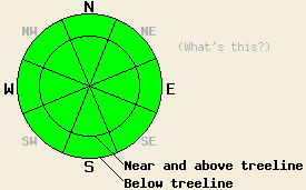
For most of today, avalanche danger will remain LOW for all elevations and aspects. Very isolated pockets of lingering wind slab may exist in recently wind loaded areas above treeline. After 5 pm today, pockets of MODERATE avalanche danger are expected to form in near treeline and above treeline terrain mainly on N-NE-E aspects as additional snowfall and wind create new wind slabs. |
|
|
|
A strong cold front is approaching the forecast area today. Wind speeds have already increased ahead of the approaching front with southwest winds gusting 60 to 90 mph over the upper elevation ridgetops. Cloud cover and scattered light snow showers are forecast for most of today. This morning, remote sensors are reporting air temperatures above 8,000' in the upper 20s to low 30s. Maximum daytime air temperatures above 7,000' are forecast to reach the low 30s to upper 40s today. Snow shower activity is expected to increase after 5 pm with a short quick burst of 1 to 3 inches of snowfall occurring with cold front passage during the overnight hours. Strong winds are forecast to continue through tomorrow, eventually shifting from southwest to northwest.
Observations made yesterday on Relay Peak (Mount Rose area) revealed poor visibility and light snowfall in the area. New snow amounts were a trace below 9,000' and 1 inch above 9,000'. Wind loaded pockets of near treeline terrain held up to 4 inches of wind loaded snow on top of melt-freeze crust. Good bonding was observed at the crust/storm snow interface. No signs of slab instability were observed in the area in either formal snowpit data or informal snowmobile slope cuts (photo, pit profile, more info).
In this area at 9,800' recent melt-freeze conditions had affected only the top 1 foot of the snowpack. The recent melt-freeze layers were in a frozen state with cold snow below, unaffected by melt-freeze. This was a significant contrast to other lower elevation portions of the forecast area where several feet of slowly refreezing wet snow exist below the recent storm snow in areas below 8,000'.
Observations made Friday on Round Top Peak (Carson Pass area) revealed pockets of wind loading up to 1 foot deep on northerly aspects. Layers of rimed snow crystals were observed within the wind loaded snow, creating a weak layer below the surface wind slab. Minimal cracking was observed from skier weight on these wind slabs. Formal snowpit tests yielded mixed results on propagation potential showing possible propagation with a low likelihood of triggering (videos, more info).
Avalanche Problem #1: Wind Slabs
There remains a very low likelihood of human triggered wind slab avalanches today. Very isolated pockets of wind slab exist above treeline in recently wind loaded areas. These slabs have formed during periods of light snowfall over the past several days and had light amounts of additional new snow loading yesterday. Slab depth is generally less than 6 inches thick, but up to 1 foot thick has been observed in some areas. Complex or extreme terrain and unsupported slopes above cliff bands on northerly aspects are the most likely place for a human triggered avalanche to occur today. Later this evening after 5 pm and during the overnight hours tonight, a further increase in wind slab size and distribution is expected to occur.
For most of today, avalanche danger will remain LOW for all elevations and aspects. Very isolated pockets of lingering wind slab may exist in recently wind loaded areas above treeline. After 5 pm today, pockets of MODERATE avalanche danger are expected to form in near treeline and above treeline terrain mainly on N-NE-E aspects as additional snowfall and wind create new wind slabs.
| 0600 temperature: | 28 to 33 deg. F. |
| Max. temperature in the last 24 hours: | 32 to 43 deg. F. |
| Average wind direction during the last 24 hours: | Southwest |
| Average wind speed during the last 24 hours: | 35 mph |
| Maximum wind gust in the last 24 hours: | 60 mph |
| New snowfall in the last 24 hours: | Trace to 1 inches |
| Total snow depth: | 44 to 82 inches |
For 7000-8000 ft: |
|||
| Sunday: | Sunday Night: | Monday: | |
| Weather: | Mostly cloudy skies with isolated showers in the morning. Scattered showers in the afternoon. | Cloudy skies with scattered snow showers in the evening. Snow showers after midnight. | Mostly cloudy skies with a chance of snow showers. |
| Temperatures: | 39 to 49 deg. F. | 17 to 22 deg. F. | 30 to 35 deg. F. |
| Wind direction: | SW | W shifting to NW | N |
| Wind speed: | 25 to 35 mph with gusts to 45 mph, increasing to 30 to 40 mph with gusts to 60 mph in the afternoon. | 30 to 40 mph with gusts to 60 mph, shifting and decreasing to 25 to 30 mph with gusts to 50 mph after midnight. | 20 to 35 mph with gusts to 50 mph, decreasing to 15 to 25 mph with gusts to 40 mph in the afternoon. |
| Expected snowfall: | 0 to trace in. | 1 to 3 in. | 0 to trace in. |
For 8000-9000 ft: |
|||
| Sunday: | Sunday Night: | Monday: | |
| Weather: | Mostly cloudy skies with scattered snow showers. | Cloudy skies with scattered snow showers in the evening. Snow showers after midnight. | Mostly cloudy skies with a chance of snow showers. |
| Temperatures: | 30 to 39 deg. F. | 12 to 17 deg. F. | 24 to 30 deg. F. |
| Wind direction: | W | SW shifting to NW | NW shifting to N |
| Wind speed: | 40 to 60 mph with gusts to 90 mph. | 45 to 60 mph with gusts to 85 mph. | 45 to 50 mph with gusts to 75 mph, shifting and decreasing to 35 to 40 mph with gusts to 60 mph in the afternoon. |
| Expected snowfall: | 0 to trace in. | 1 to 3 in. | 0 to trace in. |


This website is owned and maintained by the non-profit arm of the Sierra Avalanche Center. Some of the content is updated by the USDA avalanche forecasters including the forecasts and some observational data. The USDA is not responsible for any advertising, fund-raising events/information, or sponsorship information, or other content not related to the forecasts and the data pertaining to the forecasts.

