


For 7000 ft. to 8000 ft.
| Friday | Friday Night | Saturday | |
|---|---|---|---|
| Weather: | Cloudy with a mix of snow and rain. Snow levels between 6000 and 7500 ft. | Cloudy with rain in the evening and snow during the night. Snow levels starting between 6000 and 7500 ft and dropping to below 6000 ft. during the night | Cloudy with snow in the morning. Snow decreasing and becoming snow showers in the afternoon |
| Temperatures: | 35 to 40 deg. F. | 21 to 26 deg. F. | 25 to 30 deg. F. |
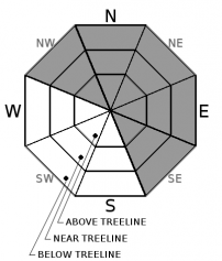
| Mid Slope Winds: | Southwest | Southwest | Southwest |
| Wind Speed: | 20 to 35 mph with gusts to 100 mph decreasing to gusts to 85 mph in the afternoon | 20 to 35 mph with gusts to 85 mph | 20 to 35 mph with gusts to 70 mph |
| Expected snowfall: | Depending on snow levels: 2 to 12 | Depending on snow levels:4 to 14 | 3 to 6 in. with a chance of 6 to 10 |
For 8000 ft. to 9000 ft.
| Friday | Friday Night | Saturday | |
|---|---|---|---|
| Weather: | Snow | Snow | Cloudy with snow in the morning. Snow decreasing and becoming snow showers in the afternoon |
| Temperatures: | 31 to 37 deg. F. | 16 to 22 deg. F. | 21 to 27 deg. F. |
| Ridge Top Winds: | Southwest | Southwest | Southwest |
| Wind Speed: | 50 to 70 mph with gusts to 135 mph decreasing to gusts to 105 mph in the afternoon | 45 to 65 mph with gusts to 125 mph decreasing to gusts to 95 mph after midnight | 30 to 50 mph with gusts to 85 mph decreasing to gusts to 65 mph in the afternoon |
| Expected snowfall: | 6 to 12 in. with a slight chance of 10 to 18 | 4 to 10 in. with a chance of 10 to 16 | 3 to 8 in. with a slight chance of 8 to 12 |


