Anatomy of a Wetslide in Davis Creek (Main Fork)

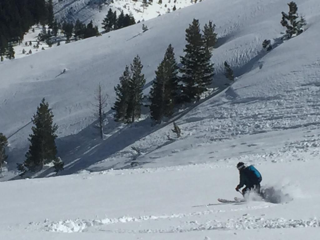
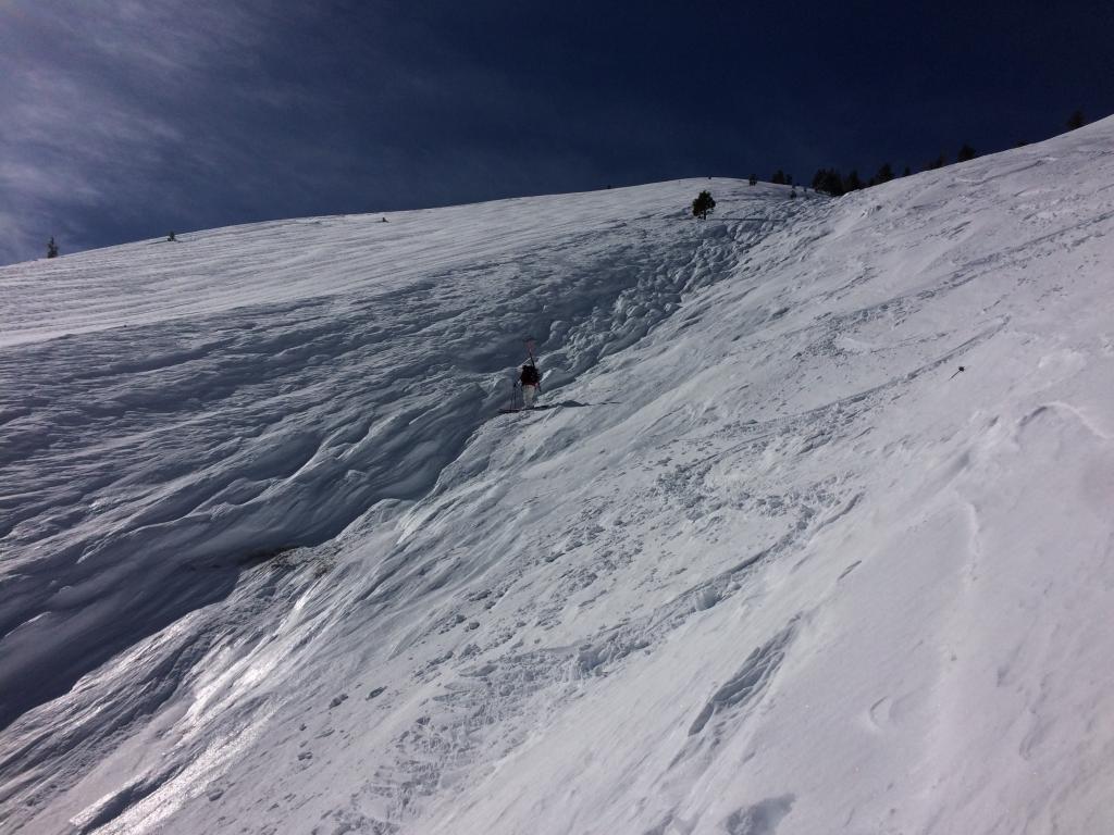
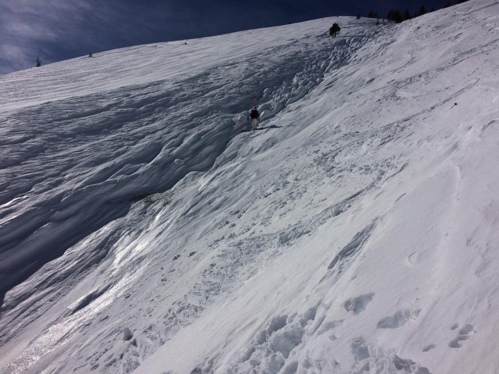
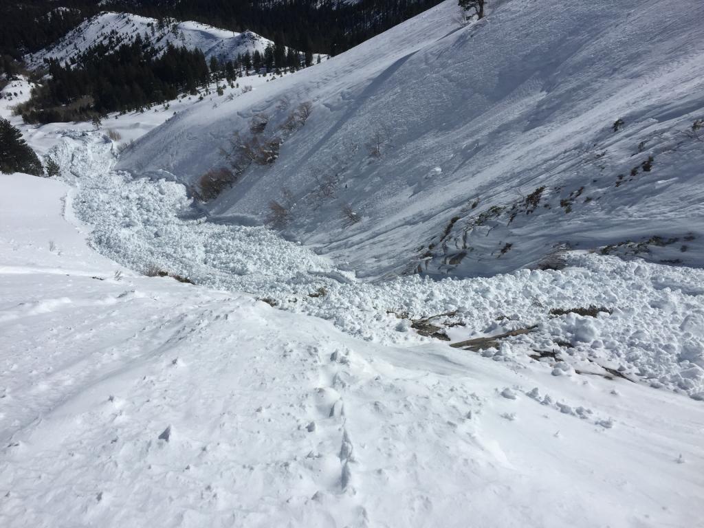
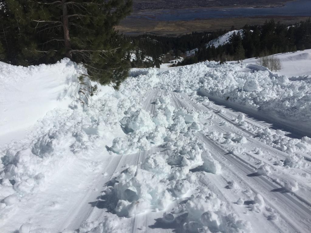
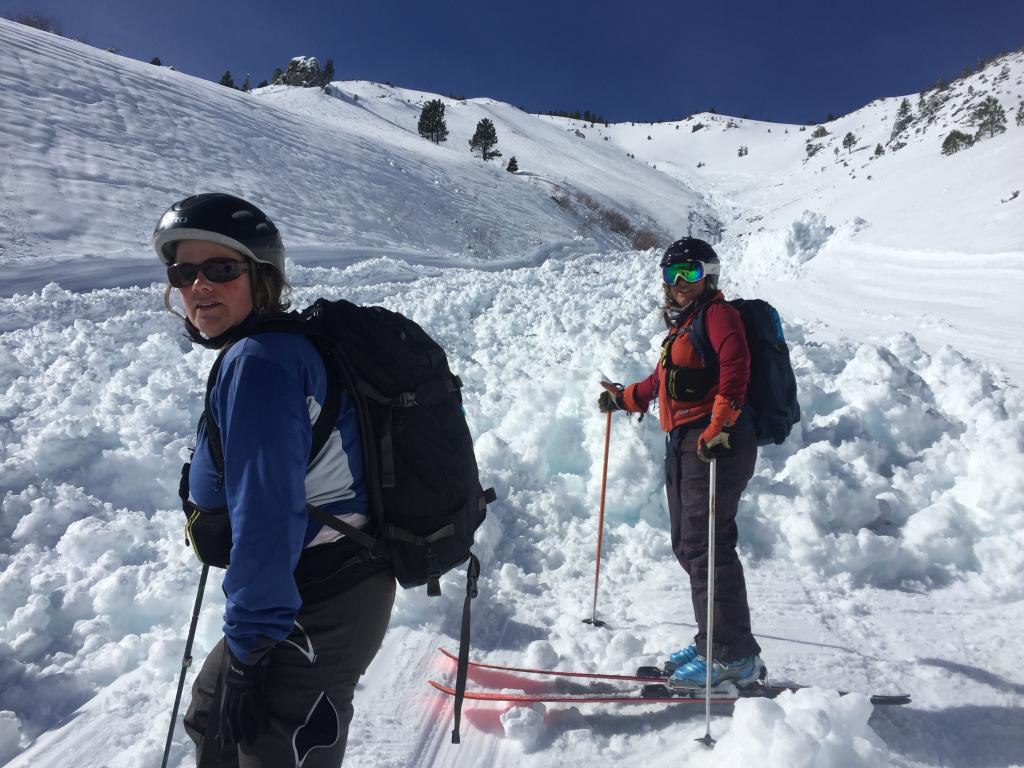
Location Name: 
Davis Creek Main Stem
Region: 
Mount Rose Area
Date and time of avalanche (best estimate if unknown): 
Sat, 02/11/2017 - 11:00
Location Map: 
United States
39° 18' 35.2656" N, 119° 52' 11.7768" W
US


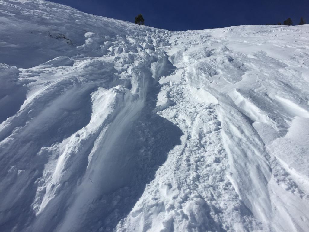
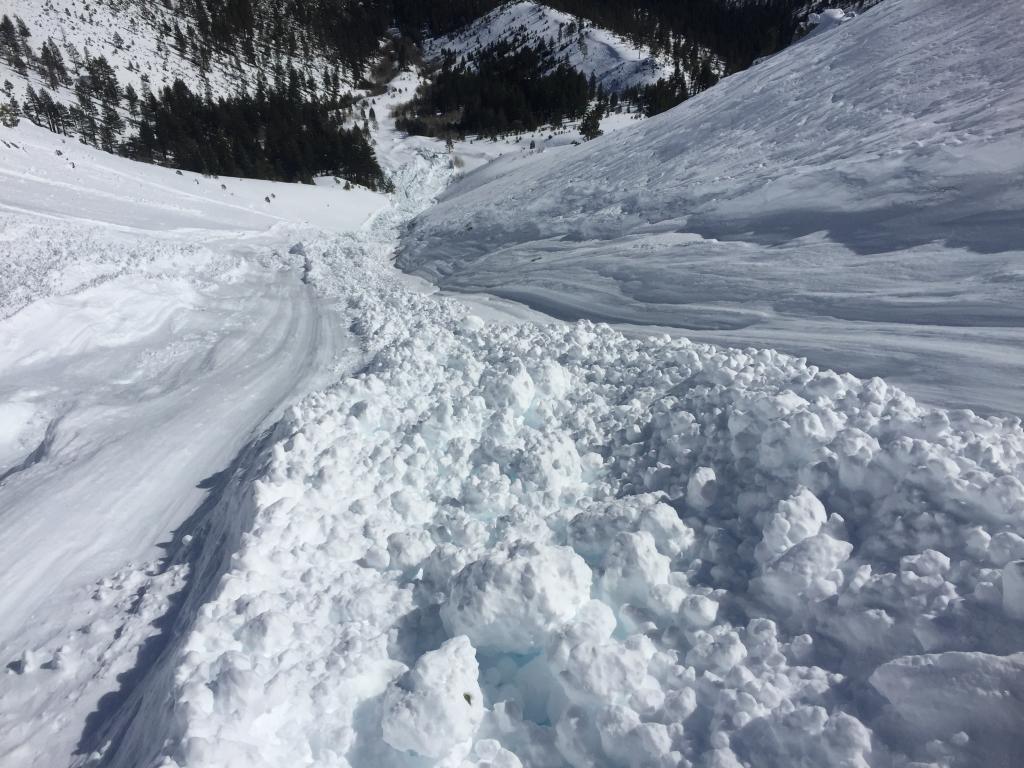
Red Flags: 
Recent avalanche activity
Recent loading by new snow, wind, or rain
Obvious avalanche path
Terrain Trap

Observation made by: Public
Avalanche Observations
Avalanche Type: 
Wet
Dry
Slab
Slope: 
40degrees
Trigger type: 
Natural
Crown Height: 
2 ft
Aspect: 
East
Weak Layer: 
Storm Snow
Avalanche Width: 
100ft.
Terrain: 
Below Treeline
Elevation: 
8 400ft.
Bed Surface: 
Storm Snow
Avalanche Length: 
3 000ft.
Number of similar avalanches: 
1
More detailed information about the avalanche: 

A member of our party took a slider about 400 vert feet down the refrozen luge trail the slide had left. Collecting her garage-sold gear allowed me to get some good shots of the slide on all if its 3000 foot path leading to a good anatomy of the slide and its path of destruction. Debris at the bottom was 10 to 15 feet deep. I would rate it as a D4. 

The crown of this avalanche was high in the drainage at about 8500 ft. on a cross loaded slope. It looked like a wind slab had released and the debris from this wind slab started entraining wet snow as it descended to lower elevations and warmer temperatures and became a wet avalanche. This wet snow kept entraining snow and became very large by the time the debris came to a rest several thousand ft. downslope. 

Avalanche Photos: 
Weather Observations
Blowing Snow: 
Yes
Cloud Cover: 
100% of the sky covered by clouds
Air temperature: 
Above Freezing
Wind Speed: 
Strong
Precipitation: 
Mixed rain and snow
Air temperature trend: 
Cooling
Wind Direction: 
Southwest
Accumulation rate: 
Greater than 1 in. per hour