The last avalanche forecast for the 2023-2024 season posted on April 21st. Thank you to all who contributed to the avalanche center this season through observations, volunteer time, and/or financial contributions.
In partnership with: 
The last avalanche forecast for the 2023-2024 season posted on April 21st. Thank you to all who contributed to the avalanche center this season through observations, volunteer time, and/or financial contributions.
| Date and time of observation or avalanche occurrence | Location | Media | Observation made by |
|---|---|---|---|
|
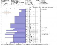
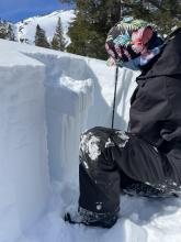
02/03/2021 - 12:30 Snowpack Observation |
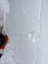
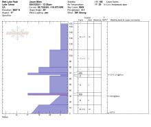
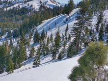
Red Lake Peak Carson Pass Area |
       |
Professional Observer |
|
02/18/2022 - 14:37 Snowpack Observation |
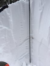
Castle/Andesite Peak Donner Summit Area |
  |
Guide Tahoe Mountain Scho |
|
02/20/2019 - 11:00 Snowpack Observation |
Polaris Point Blackwood Canyon or Ward Canyon Area |
  |
Forecaster |
|
02/09/2023 - 12:00 Snowpack Observation |
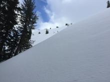
Calm clear day on Trimmer Peak Luther Pass Area (including Job and Freel) |
      |
Professional Observer |
|
02/27/2020 - 11:30 Snowpack Observation |
Mt. Judah Donner Summit Area |
  |
Forecaster |
|
02/06/2021 - 11:30 Avalanche Observation |
Unnamed Flattop Pk at head of Pole Creek drainage Cabin Creek, Deep Creek, or Pole Creek Area |
      |
Forecaster |
|
02/23/2022 - 12:00 Snowpack Observation |
Elephant's Hump Carson Pass Area |
|
Professional Observer |
|
02/23/2019 - 10:30 Snowpack Observation |
Ralston Peak Desolation Wilderness Area (including Emerald Bay) |
   |
Public |
|
02/12/2023 - 12:00 Avalanche Observation |
Galena Creek Drainage Mount Rose Area |
 |
Public |
|
03/02/2020 - 11:00 Snowpack Observation |
Relay Ridge Mount Rose Area |
  |
Public |
|
02/09/2021 - 04:30 Snowpack Observation |
Blue Lakes Carson Pass Area |
Public | |
|
02/27/2022 - 13:30 Snowpack Observation |
Red Lake Peak Carson Pass Area |
  |
Educator Lake Tahoe Community College - Wilderness Educati |
|
02/20/2018 - 12:00 Snowpack Observation |
Black Butte Carson Pass Area |
 |
Professional Observer |
|
02/25/2019 - 09:30 Snowpack Observation |
Fire Plug Mount Rose Area |
   |
Public |
|
02/18/2023 - 13:52 Snowpack Observation |
Trees east of Polaris bowl Carson Pass Area |
   |
Public |


This website is owned and maintained by the non-profit arm of the Sierra Avalanche Center. Some of the content is updated by the USDA avalanche forecasters including the forecasts and some observational data. The USDA is not responsible for any advertising, fund-raising events/information, or sponsorship information, or other content not related to the forecasts and the data pertaining to the forecasts.