In partnership with: 
| Date and time of observation or avalanche occurrence | Location | Media | Observation made by |
|---|---|---|---|
|
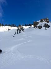
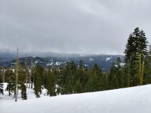
04/18/2018 - 10:30 Snowpack Observation |
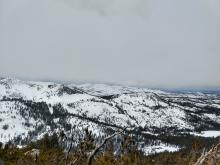
Rubicon Peak West Shore Area |
   |
Forecaster |
|
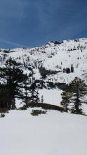
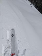
04/17/2018 - 12:30 Snowpack Observation |
Slab Cliffs Mount Rose Area |
 |
Forecaster |
|
04/16/2018 - 12:30 Snowpack Observation |
Carson Pass south near Elephant's Back Carson Pass Area |
    |
Professional Observer |
|
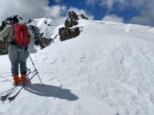
04/16/2018 - 11:00 Snowpack Observation |
Andesite Peak Donner Summit Area |
|
Forecaster |
|
04/15/2018 - 11:00 Snowpack Observation |
Powderhouse Peak Luther Pass Area (including Job and Freel) |
  |
Professional Observer |
|
04/15/2018 - 09:30 Snowpack Observation |
Andesite Peak Donner Summit Area |
  |
Forecaster |
|
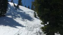
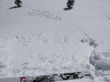
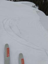
04/14/2018 - 16:45 Avalanche Observation |
Looking at the area below Needle Peak behind Squaw' Shirley Lake Donner Summit Area |
 |
Public |
|
04/14/2018 - 12:00 Snowpack Observation |
Stevens Peak Carson Pass Area |
  |
Forecaster |
|
04/13/2018 - 13:15 Snowpack Observation |
Maggie's Peak South Desolation Wilderness Area (including Emerald Bay) |
  |
Forecaster |
|
04/12/2018 - 18:00 Snowpack Observation |
North Bowl Castle Peak Donner Summit Area |
   |
Public |
|
04/12/2018 - 11:00 Snowpack Observation |
Andesite and Castle Peak Donner Summit Area |
|
Forecaster |
|
04/12/2018 - 01:15 Snowpack Observation |
Mt. Judah Donner Summit Area |
Public | |
|
04/11/2018 - 12:00 Snowpack Observation |
Chickadee Ridge Mount Rose Area |
  |
Forecaster |
|
04/11/2018 - 03:30 Avalanche Observation |
Mr Rose trail just past waterfall Mount Rose Area |
     |
Public |
|
04/10/2018 - 12:30 Snowpack Observation |
Mt. Judah Donner Summit Area |
   |
Forecaster |


This website is owned and maintained by the non-profit arm of the Sierra Avalanche Center. Some of the content is updated by the USDA avalanche forecasters including the forecasts and some observational data. The USDA is not responsible for any advertising, fund-raising events/information, or sponsorship information, or other content not related to the forecasts and the data pertaining to the forecasts.