In partnership with: 
| Date and time of observation or avalanche occurrence | Location | Media | Observation made by |
|---|---|---|---|
|
02/12/2019 - 10:45 Snowpack Observation |
above Crystal Bay Mount Rose Area |
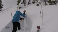 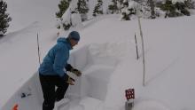 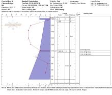 |
Guide Donner Summit Avalanche Semina |
|
02/12/2019 - 10:30 Snowpack Observation |
Centerville Peak Luther Pass Area (including Job and Freel) |
   |
Public |
|
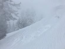
02/12/2019 - 10:30 Avalanche Observation |
Across from River Ranch Sawtooth Ridge to Tahoe City |
Public | |
|
02/12/2019 - 10:00 Snowpack Observation |
Munchkins Area Sawtooth Ridge to Tahoe City |
  |
Forecaster |
|
02/11/2019 - 12:30 Snowpack Observation |
Tallac Corkscrew Desolation Wilderness Area (including Emerald Bay) |
Public | |
|
02/11/2019 - 11:45 Snowpack Observation |
Tamarack Peak Mount Rose Area |
     |
Forecaster |
|
02/10/2019 - 14:00 Snowpack Observation |
Poison Canyon Bear Valley Area |
 |
Guide California Ski Guid |
|
02/10/2019 - 13:15 Snowpack Observation |
Below Poulsen's Peak, Olympic Valley Sawtooth Ridge to Tahoe City |
Guide Alpenglow Expeditio |
|
|
02/10/2019 - 12:30 Snowpack Observation |
Andesite Ridge Donner Summit Area |
    |
Forecaster |
|
02/10/2019 - 11:30 Snowpack Observation |
Cottonwood Hill Sawtooth Ridge to Tahoe City |
 |
Public |
|
02/10/2019 - 08:00 Snowpack Observation |
Hope Valley & Waterhouse Luther Pass Area (including Job and Freel) |
Public | |
|
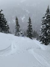
02/10/2019 - 02:00 Avalanche Observation |
Andesite Peak Donner Summit Area |
   |
Forecaster |
|
02/09/2019 - 23:00 Avalanche Observation |
Ridge between Forks of Coldstream Creeks Cabin Creek, Deep Creek, or Pole Creek Area |
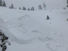  |
Public |
|
02/09/2019 - 15:00 Snowpack Observation |
Brockway Summit Sawtooth Ridge to Tahoe City |
 |
Public |
|
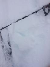
02/09/2019 - 13:15 Avalanche Observation |
Round Valley Bear Valley Area |
    |
Guide California Ski Guid |


This website is owned and maintained by the non-profit arm of the Sierra Avalanche Center. Some of the content is updated by the USDA avalanche forecasters including the forecasts and some observational data. The USDA is not responsible for any advertising, fund-raising events/information, or sponsorship information, or other content not related to the forecasts and the data pertaining to the forecasts.


