In partnership with: 
| Date and time of observation or avalanche occurrence | Location | Media | Observation made by |
|---|---|---|---|
|
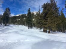
02/01/2019 - 10:30 Snowpack Observation |
Jakes West Shore Area |
  |
Public |
|
01/31/2019 - 13:00 Snowpack Observation |
Stevens Peak Carson Pass Area |
  |
Forecaster |
|
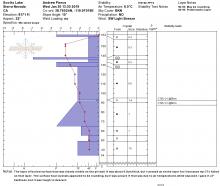
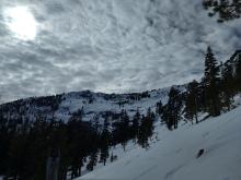
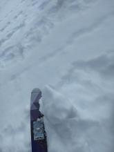
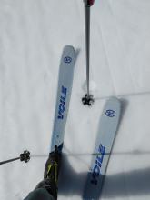
01/31/2019 - 12:15 Snowpack Observation |
Jake's Peak West Shore Area |
 |
Public |
|
01/31/2019 - 11:30 Snowpack Observation |
Castle Peak Donner Summit Area |
  |
Professional Observer |
|
01/31/2019 - 10:15 Snowpack Observation |
Johnson Canyon Donner Summit Area |
   |
Forecaster |
|
01/30/2019 - 15:00 Snowpack Observation |
Rose Knob Mount Rose Area |
Public | |
|
01/30/2019 - 13:30 Snowpack Observation |
Scotts Lake Luther Pass Area (including Job and Freel) |
     |
Public |
|
01/30/2019 - 12:00 Snowpack Observation |
Angora Peak Desolation Wilderness Area (including Emerald Bay) |
  |
Professional Observer |
|
01/30/2019 - 12:00 Snowpack Observation |
Jakes Peak West Shore Area |
    |
Forecaster |
|
01/30/2019 - 11:45 Snowpack Observation |
Rose Knob Peak Mount Rose Area |
   |
Forecaster |
|
01/29/2019 - 11:30 Snowpack Observation |
Slide Mountain Mount Rose Area |
   |
Forecaster |
|
01/28/2019 - 12:00 Snowpack Observation |
Castle Peak Donner Summit Area |
 |
Forecaster |
|
01/28/2019 - 10:30 Snowpack Observation |
Stevens Peak Carson Pass Area |
    |
Forecaster |
|
01/27/2019 - 14:30 Snowpack Observation |
White Rock Lake and surrounding are Independence Lake Area |
Public | |
|
01/26/2019 - 14:45 Snowpack Observation |
The Grills AKA Tom's Meadow Independence Lake Area |
Public |


This website is owned and maintained by the non-profit arm of the Sierra Avalanche Center. Some of the content is updated by the USDA avalanche forecasters including the forecasts and some observational data. The USDA is not responsible for any advertising, fund-raising events/information, or sponsorship information, or other content not related to the forecasts and the data pertaining to the forecasts.

