In partnership with: 
| Date and time of observation or avalanche occurrence | Location | Media | Observation made by |
|---|---|---|---|
|
02/07/2019 - 12:00 Snowpack Observation |
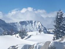
Davis Creek Mount Rose Area |
 |
Forecaster |
|
02/07/2019 - 08:00 Snowpack Observation |
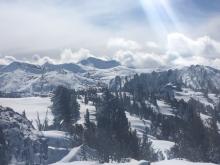
Shirley Canyon Cabin Creek, Deep Creek, or Pole Creek Area |
 |
Public |
|
02/06/2019 - 14:00 Snowpack Observation |
Shirley Canyon Cabin Creek, Deep Creek, or Pole Creek Area |
Public | |
|
02/06/2019 - 13:00 Snowpack Observation |
Blackwood Ridge Blackwood Canyon or Ward Canyon Area |
   |
Forecaster |
|
02/06/2019 - 12:00 Snowpack Observation |
Snowboard Bowl Carson Pass Area |
    |
Professional Observer |
|
02/06/2019 - 11:00 Snowpack Observation |
Centerville Peak East Shore Area |
    |
Public |
|
02/06/2019 - 10:00 Snowpack Observation |
Flagpole Peak Echo Summit Area |
    |
Professional Observer |
|
02/05/2019 - 15:00 Snowpack Observation |
Duane Bliss East Shore Area |
   |
Professional Observer |
|
02/05/2019 - 13:00 Snowpack Observation |
Rubicon Peak West Shore Area |
Public | |
|
02/05/2019 - 12:00 Snowpack Observation |
Jakes Peak West Shore Area |
     |
Forecaster |
|
02/05/2019 - 12:00 Avalanche Observation |
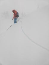
Sierra Crest above Bradley Hut Cabin Creek, Deep Creek, or Pole Creek Area |
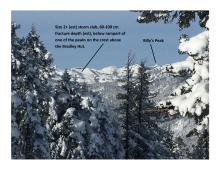 |
Educator Donner Summit Avalanche Semina |
|
02/05/2019 - 11:30 Snowpack Observation |
Tamarack Peak Mount Rose Area |
  |
Forecaster |
|
02/05/2019 - 09:30 Avalanche Observation |
Davis Creek Mount Rose Area |
      |
Forecaster |
|
02/05/2019 - 01:00 Avalanche Observation |
Crag Peak West Shore Area |
  |
Forecaster |
|
02/04/2019 - 12:30 Snowpack Observation |
Incline Lake Peak Mount Rose Area |
 |
Forecaster |


This website is owned and maintained by the non-profit arm of the Sierra Avalanche Center. Some of the content is updated by the USDA avalanche forecasters including the forecasts and some observational data. The USDA is not responsible for any advertising, fund-raising events/information, or sponsorship information, or other content not related to the forecasts and the data pertaining to the forecasts.

