In partnership with: 
| Date and time of observation or avalanche occurrence | Location | Media | Observation made by |
|---|---|---|---|
|
03/30/2017 - 13:30 Snowpack Observation |
Andesite Ridge Donner Summit Area |
  |
Forecaster |
|
03/30/2017 - 13:00 Snowpack Observation |
East Ridge Tamarack Peak Mount Rose Area |
|
Forecaster |
|
03/29/2017 - 12:00 Snowpack Observation |
Fireplug/Mt. Rose Mount Rose Area |
     |
Forecaster |
|
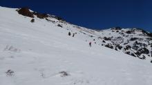
03/29/2017 - 11:30 Snowpack Observation |
South Side Castle Peak Donner Summit Area |
  |
Educator Sierra Nevada Colle |
|
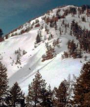
03/28/2017 - 12:50 Avalanche Observation |
Third Creek Drainage/Jennifer Street Mount Rose Area |
   |
Public |
|
03/28/2017 - 12:00 Snowpack Observation |
Incline Lake Peak Mount Rose Area |
  |
Forecaster |
|
03/28/2017 - 11:00 Snowpack Observation |
Red Lake Peak Carson Pass Area |
 |
Forecaster |
|
03/27/2017 - 13:00 Snowpack Observation |
Tamarack Peak Mount Rose Area |
  |
Forecaster |
|
03/27/2017 - 10:30 Snowpack Observation |
Lincoln Ridge Yuba Pass Area |
   |
Forecaster |
|
03/26/2017 - 13:00 Snowpack Observation |
Negro Canyon Donner Summit Area |
   |
Guide Tahoe Mountain Scho |
|
03/26/2017 - 11:00 Snowpack Observation |
Elephant's Hump Carson Pass Area |
   |
Forecaster |
|
03/25/2017 - 16:00 Snowpack Observation |
Talking Mountain/Becker Ridge Echo Summit Area |
 |
Public |
|
03/25/2017 - 14:00 Snowpack Observation |
Negro Canyon Donner Summit Area |
   |
Guide Tahoe Mountain Scho |
|
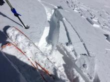
03/25/2017 - 13:22 Avalanche Observation |
Outside of boundary in Snow Valley Bear Valley Area |
 |
Public |
|
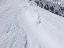
03/25/2017 - 13:00 Snowpack Observation |
NE slope, Silver Peak Cabin Creek, Deep Creek, or Pole Creek Area |
Public |


This website is owned and maintained by the non-profit arm of the Sierra Avalanche Center. Some of the content is updated by the USDA avalanche forecasters including the forecasts and some observational data. The USDA is not responsible for any advertising, fund-raising events/information, or sponsorship information, or other content not related to the forecasts and the data pertaining to the forecasts.