In partnership with: 
| Date and time of observation or avalanche occurrence | Location | Media | Observation made by |
|---|---|---|---|
|
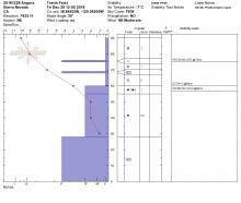
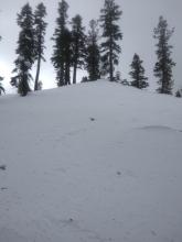
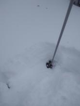
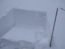
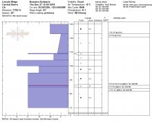
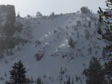
01/02/2019 - 10:00 Snowpack Observation |
Porcupine Ridge Luther Pass Area (including Job and Freel) |
    |
Professional Observer |
|
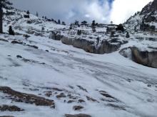
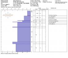
01/01/2019 - 13:00 Snowpack Observation |
Indian Valley Ebbetts Pass Area |
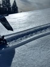 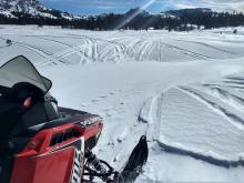 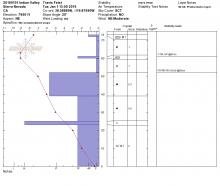 |
Professional Observer |
|
12/31/2018 - 12:00 Snowpack Observation |
Mt Tallac Desolation Wilderness Area (including Emerald Bay) |
   |
Professional Observer |
|
12/30/2018 - 12:30 Snowpack Observation |
Tamarack Peak Mount Rose Area |
 |
Educator Tahoe Mountain Scho |
|
12/30/2018 - 11:00 Snowpack Observation |
Silver Peak Cabin Creek, Deep Creek, or Pole Creek Area |
  |
Forecaster |
|
12/29/2018 - 14:15 Snowpack Observation |
Andesite Peak Donner Summit Area |
  |
Educator Tahoe Mountain Scho |
|
12/29/2018 - 14:00 Snowpack Observation |
South shoulder of Stevens Peak Carson Pass Area |
     |
Professional Observer |
|
12/29/2018 - 11:45 Snowpack Observation |
Upper Cold Stream Cabin Creek, Deep Creek, or Pole Creek Area |
  |
Forecaster |
|
12/28/2018 - 14:45 Snowpack Observation |
Pike's Peak (near highway 108 sno-park) Outside of the Forecast Area |
Public | |
|
12/28/2018 - 12:00 Snowpack Observation |
Angora Peak Echo Summit Area |
    |
Professional Observer |
|
12/28/2018 - 12:00 Snowpack Observation |
Rubicon Peak West Shore Area |
   |
Forecaster |
|
12/28/2018 - 12:00 Snowpack Observation |
Chickadee Ridge Mount Rose Area |
Public | |
|
12/27/2018 - 13:00 Snowpack Observation |
Trimmer Bonus Luther Pass Area (including Job and Freel) |
   |
Professional Observer |
|
12/27/2018 - 12:00 Snowpack Observation |
Lincoln Ridge Yuba Pass Area |
     |
Forecaster |
|
12/27/2018 - 11:00 Snowpack Observation |
Slab Cliffs Mount Rose Area |
   |
Forecaster |


This website is owned and maintained by the non-profit arm of the Sierra Avalanche Center. Some of the content is updated by the USDA avalanche forecasters including the forecasts and some observational data. The USDA is not responsible for any advertising, fund-raising events/information, or sponsorship information, or other content not related to the forecasts and the data pertaining to the forecasts.

