In partnership with: 
| Date and time of observation or avalanche occurrence | Location | Media | Observation made by |
|---|---|---|---|
|
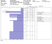
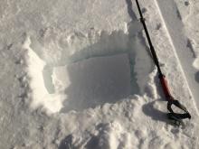
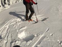
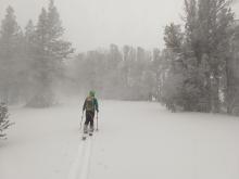
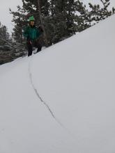
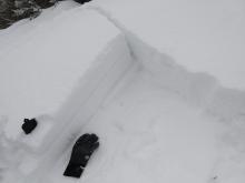
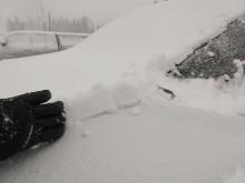
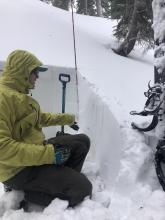
12/26/2018 - 14:00 Snowpack Observation |
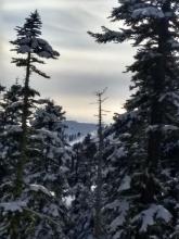
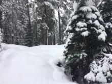
Munchkins Zone - East Bowl Blackwood Canyon or Ward Canyon Area |
    |
Public |
|
12/26/2018 - 12:15 Snowpack Observation |
Deep Creek Cabin Creek, Deep Creek, or Pole Creek Area |
    |
Forecaster |
|
12/25/2018 - 15:00 Snowpack Observation |
Castle Peak Donner Summit Area |
   |
Public |
|
12/25/2018 - 12:00 Snowpack Observation |
Thunder Mtn Carson Pass Area |
|
Professional Observer |
|
12/25/2018 - 11:30 Snowpack Observation |
1.2 miles west of white rock lake Independence Lake Area |
Public | |
|
12/25/2018 - 03:00 Snowpack Observation |
Fireplug Mount Rose Area |
 |
Public |
|
12/24/2018 - 14:00 Snowpack Observation |
Red Lake Peak Carson Pass Area |
  |
Professional Observer |
|
12/24/2018 - 11:30 Snowpack Observation |
Tamarack Peak Mount Rose Area |
    |
Forecaster |
|
12/24/2018 - 11:00 Snowpack Observation |
Donner Pass Donner Summit Area |
 |
Guide Tahoe Mountain Scho |
|
12/23/2018 - 14:00 Snowpack Observation |
Scott’s peak Cabin Creek, Deep Creek, or Pole Creek Area |
 |
Public |
|
12/23/2018 - 11:00 Snowpack Observation |
Peak 8040' Yuba Pass Area |
   |
Forecaster |
|
12/22/2018 - 15:00 Snowpack Observation |
Andesite Peak Donner Summit Area |
 |
Educator Tahoe Mountain Scho |
|
12/22/2018 - 15:00 Snowpack Observation |
Shirley Canyon Cabin Creek, Deep Creek, or Pole Creek Area |
Guide Alpenglow Expeditio |
|
|
12/22/2018 - 11:30 Snowpack Observation |
Elephant's Back Carson Pass Area |
|
Professional Observer |
|
12/22/2018 - 11:00 Snowpack Observation |
Tamarack Peak Mount Rose Area |
   |
Forecaster |


This website is owned and maintained by the non-profit arm of the Sierra Avalanche Center. Some of the content is updated by the USDA avalanche forecasters including the forecasts and some observational data. The USDA is not responsible for any advertising, fund-raising events/information, or sponsorship information, or other content not related to the forecasts and the data pertaining to the forecasts.