In partnership with: 
These observations document past conditions at a small and variable scale. They are not to be confused with an avalanche forecast. They come from a variety of sources. We can only vouch for the quality of those produced by the SAC forecasters and professional observers.
| Date and time of observation or avalanche occurrence | Location | Snowpack, Avalanche, Weather Images | Observation made by |
|---|---|---|---|
|
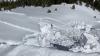
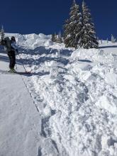
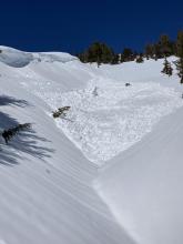
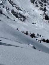
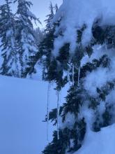
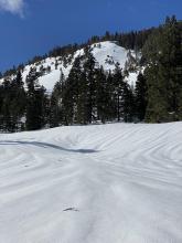
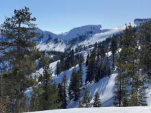
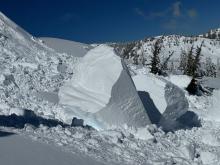
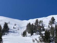
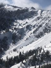
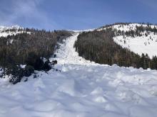
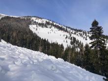
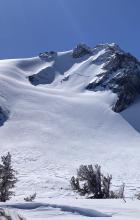
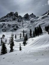
03/16/2023 - 13:00 Avalanche Observation |
Polaris Bowl Carson Pass Area |
  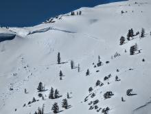    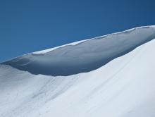  |
Professional Observer |
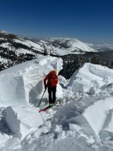
|
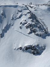
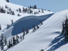
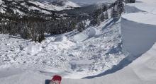
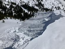
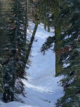
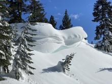
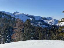
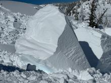
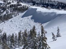
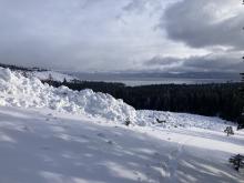
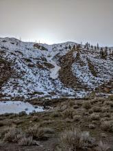
03/16/2023 - 12:58 Avalanche Observation |
Tallac Desolation Wilderness Area (including Emerald Bay) |
Public | |
|
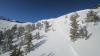
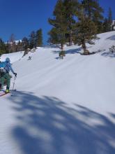
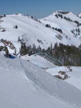
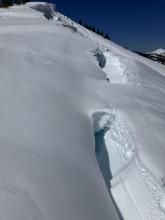
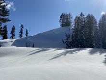
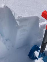
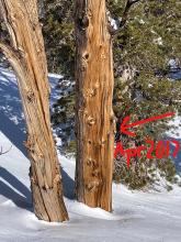
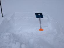
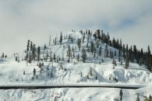
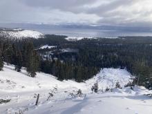
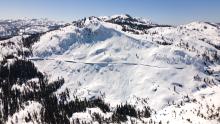
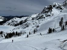
03/16/2023 - 12:30 Snowpack Observation |
Incline Lake Peak |
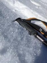  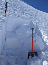      |
Forecaster |
|
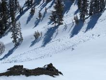
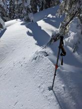
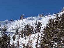
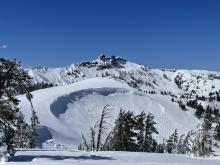
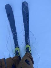
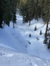
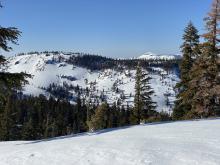
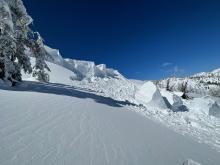
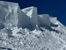
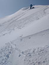
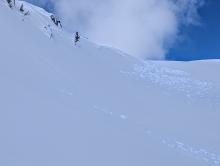
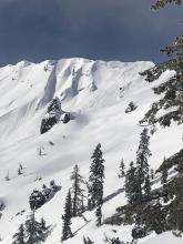
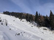
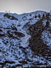
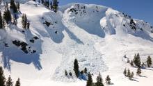
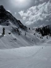
03/16/2023 - 12:15 Avalanche Observation |
Peak 8,426' Cabin Creek, Deep Creek, or Pole Creek Area |
 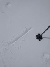   |
Forecaster |
|
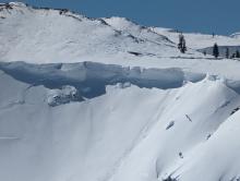
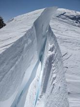
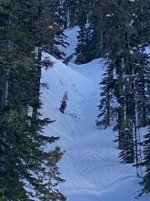
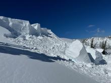
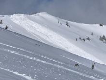
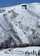
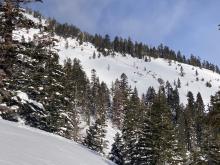
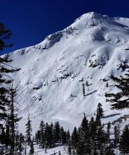
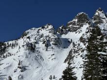
03/16/2023 - 12:00 Avalanche Observation |
Castle Peak Donner Summit Area |
 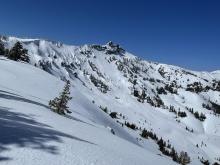   |
Guide Blackbird Mountain Guides |
|
03/16/2023 - 01:30 Avalanche Observation |
Johnson Canyon Donner Summit Area |
|
Public |
|
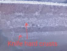
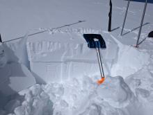
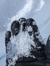
03/15/2023 - 17:45 Snowpack Observation |
Incline Peak Mount Rose Area |
  |
Public |
|
03/15/2023 - 15:00 Snowpack Observation |
Deep Creek Cabin Creek, Deep Creek, or Pole Creek Area |
         |
Public |
|
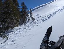
03/15/2023 - 12:30 Avalanche Observation |
Incline Peak Mount Rose Area |
     |
Guide Blackbird Mountain Guides |
|
03/15/2023 - 12:00 Avalanche Observation |
Tamarack Peak Mount Rose Area |
      |
Forecaster |
|
03/15/2023 - 12:00 Avalanche Observation |
Observed from Sierra @ Tahoe Echo Summit Area |
 |
Public |
|
03/15/2023 - 11:00 Avalanche Observation |
Elephants Back Carson Pass Area |
    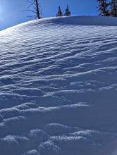  |
Professional Observer |
|
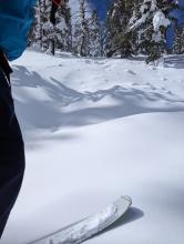
03/15/2023 - 10:00 Avalanche Observation |
Ward Canyon Blackwood Canyon or Ward Canyon Area |
   |
Guide Blackbird Mountain Guides |
|
03/15/2023 - 09:43 Avalanche Observation |
Trestle Peak taken from Wolfe Estates Donner Summit Area |
  |
Public |
|
03/15/2023 - 08:00 Avalanche Observation |
Corkscrew Desolation Wilderness Area (including Emerald Bay) |
Public | |
|
03/14/2023 - 18:04 Avalanche Observation |
Mount Tallac Desolation Wilderness Area (including Emerald Bay) |
      |
Public |
|
03/14/2023 - 18:00 Avalanche Observation |
Truckee River Canyon Near Floriston Outside of the Forecast Area |
  |
Forecaster |
|
03/14/2023 - 14:20 Avalanche Observation |
Carson Pass Area Carson Pass Area |
  |
Public |
|
03/14/2023 - 12:04 Avalanche Observation |
Donner Peak Donner Summit Area |
  |
Public |
|
03/14/2023 - 12:00 Snowpack Observation |
Sierra Buttes Yuba Pass Area |
    |
Public |


This website is owned and maintained by the non-profit arm of the Sierra Avalanche Center. Some of the content is updated by the USDA avalanche forecasters including the forecasts and some observational data. The USDA is not responsible for any advertising, fund-raising events/information, or sponsorship information, or other content not related to the forecasts and the data pertaining to the forecasts.