In partnership with: 
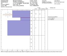
| Date and time of observation or avalanche occurrence | Location | Media | Observation made by |
|---|---|---|---|
|
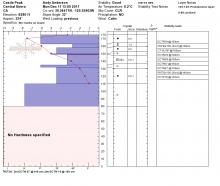
12/14/2017 - 16:00 Snowpack Observation |
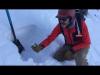
West side Relay Peak Mount Rose Area |
   |
Public |
|
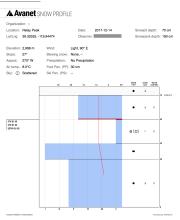
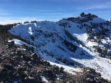
12/14/2017 - 11:00 Snowpack Observation |
Andesite Peak and S aspect of Castle Pk Donner Summit Area |
 |
Forecaster |
|
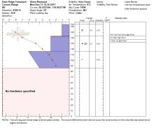
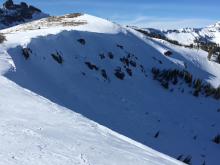
12/13/2017 - 15:27 Avalanche Observation |
Castle Peak Donner Summit Area |
  |
Public |
|
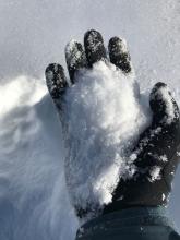
12/13/2017 - 12:00 Snowpack Observation |
Chickadee Ridge Mount Rose Area |
   |
Forecaster |
|
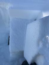
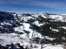
12/13/2017 - 11:30 Snowpack Observation |
Andesite Peak Donner Summit Area |
  |
Forecaster |
|
12/12/2017 - 11:30 Snowpack Observation |
Basin Peak Donner Summit Area |
 |
Public |
|
12/11/2017 - 13:00 Snowpack Observation |
Castle Peak Donner Summit Area |
     |
Forecaster |
|
12/11/2017 - 12:00 Snowpack Observation |
East Ridge Tamarack Peak Mount Rose Area |
 |
Forecaster |
|
12/10/2017 - 12:30 Snowpack Observation |
Becker Ridge Echo Summit Area |
    |
Forecaster |
|
12/10/2017 - 12:10 Snowpack Observation |
Castle Pass Donner Summit Area |
Educator Tahoe Mountain Scho |
|
|
12/10/2017 - 11:35 Avalanche Observation |
Mount Price Desolation Wilderness Area (including Emerald Bay) |
Public | |
|
12/09/2017 - 12:00 Snowpack Observation |
Relay Peak Mount Rose Area |
    |
Forecaster |
|
12/09/2017 - 11:00 Snowpack Observation |
Elephants Back Carson Pass Area |
    |
Public |
|
12/08/2017 - 12:30 Snowpack Observation |
Castle Peak Donner Summit Area |
   |
Forecaster |
|
12/08/2017 - 10:00 Snowpack Observation |
Red Lake Peak Ridge Carson Pass Area |

|
Professional Observer |


This website is owned and maintained by the non-profit arm of the Sierra Avalanche Center. Some of the content is updated by the USDA avalanche forecasters including the forecasts and some observational data. The USDA is not responsible for any advertising, fund-raising events/information, or sponsorship information, or other content not related to the forecasts and the data pertaining to the forecasts.