In partnership with: 
| Date and time of observation or avalanche occurrence | Location | Media | Observation made by |
|---|---|---|---|
|
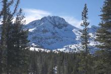
11/17/2017 - 11:00 Snowpack Observation |
mt lincoln Donner Summit Area |
  |
Public |
|
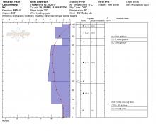
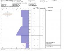
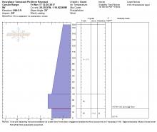
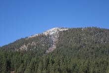
11/17/2017 - 10:00 Snowpack Observation |
Elephant's Back Carson Pass Area |
    |
Professional Observer |
|
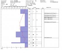
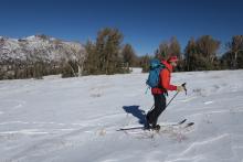
11/16/2017 - 12:00 Snowpack Observation |
Tamarack Peak Mount Rose Area |
|
Forecaster |
|
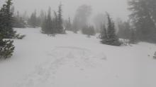
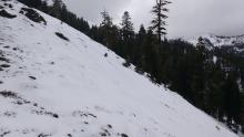
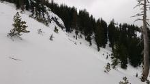
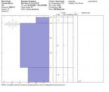
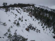
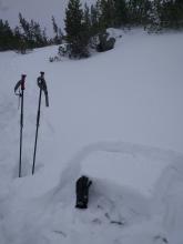
11/16/2017 - 11:00 Avalanche Observation |
Relay Pk - Broncho Chutes Mount Rose Area |
 |
Public |
|
11/16/2017 - 10:15 Snowpack Observation |
tamarack peak Mount Rose Area |
 |
Public |
|
11/16/2017 - 10:00 Snowpack Observation |
Tamarack. About 9,000’ Mount Rose Area |
  |
Public |
|
11/16/2017 - 09:00 Avalanche Observation |
Hourglass Bowl Mount Rose Area |
    |
Forecaster |
|
11/16/2017 - 09:00 Avalanche Observation |
Tamarack Pk - Hourglass Bowl Mount Rose Area |
Public | |
|
11/16/2017 - 09:00 Avalanche Observation |
Hourglass bowl Mount Rose Area |
Public | |
|
11/15/2017 - 12:00 Snowpack Observation |
East Ridge of Relay Pk Mount Rose Area |
 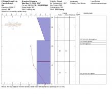 |
Forecaster |
|
11/15/2017 - 08:30 Snowpack Observation |
Rubicon Peak West Shore Area |
    |
Forecaster |
|
11/14/2017 - 13:00 Snowpack Observation |
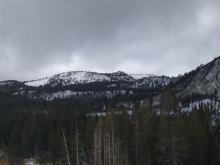
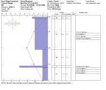
Castle Peak Donner Summit Area |
  |
Forecaster |
|
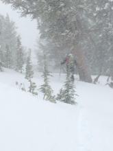
11/14/2017 - 12:00 Snowpack Observation |
Elephant's Back Carson Pass Area |
     |
Professional Observer |
|
11/13/2017 - 13:00 Snowpack Observation |
Silver Peak Cabin Creek, Deep Creek, or Pole Creek Area |
   |
Forecaster |
|
11/13/2017 - 12:00 Snowpack Observation |
Tamarack Peak Mount Rose Area |
    |
Forecaster |


This website is owned and maintained by the non-profit arm of the Sierra Avalanche Center. Some of the content is updated by the USDA avalanche forecasters including the forecasts and some observational data. The USDA is not responsible for any advertising, fund-raising events/information, or sponsorship information, or other content not related to the forecasts and the data pertaining to the forecasts.