In partnership with: 
| Date and time of observation or avalanche occurrence | Location | Media | Observation made by |
|---|---|---|---|
|
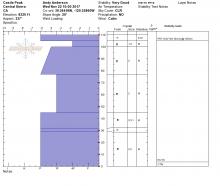
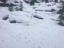
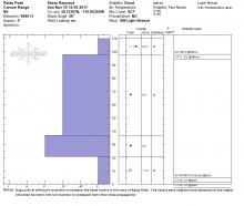
11/26/2017 - 12:00 Snowpack Observation |
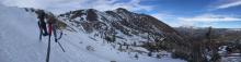
Barker Peak Blackwood Canyon or Ward Canyon Area |
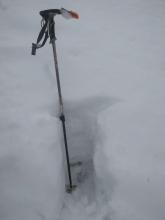   |
Forecaster |
|
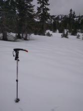
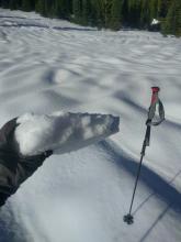
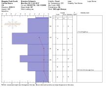
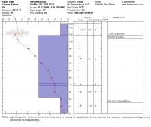
11/25/2017 - 14:00 Snowpack Observation |
Relay Peak Mount Rose Area |
  |
Forecaster |
|
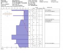
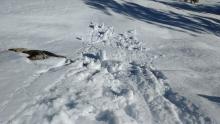
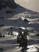
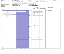
11/24/2017 - 13:30 Snowpack Observation |
Red Lake Peak Carson Pass Area |
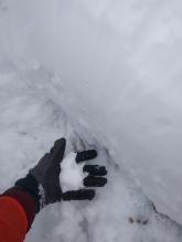 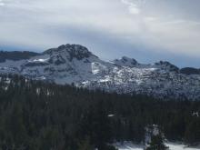 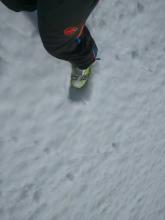  |
Forecaster |
|
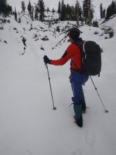
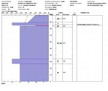
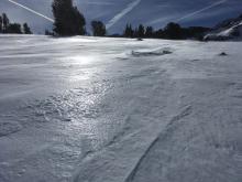
11/24/2017 - 13:05 Snowpack Observation |
Round Top Carson Pass Area |
  |
Public |
|
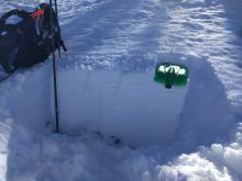
11/22/2017 - 10:30 Snowpack Observation |
Castle Peak Donner Summit Area |
   |
Forecaster |
|
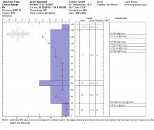
11/21/2017 - 23:15 Snowpack Observation |
Incline Lake Pk and points to the NW. Mount Rose Area |
 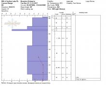 |
Forecaster |
|
11/20/2017 - 12:00 Snowpack Observation |
Maggies Peak South Desolation Wilderness Area (including Emerald Bay) |
  |
Forecaster |
|
11/19/2017 - 13:00 Snowpack Observation |
Elephant's Back and Round Top Carson Pass Area |
  |
Professional Observer |
|
11/19/2017 - 12:00 Snowpack Observation |
Sisters Carson Pass Area |
  |
Professional Observer |
|
11/19/2017 - 12:00 Snowpack Observation |
Relay Peak Mount Rose Area |
  |
Forecaster |
|
11/18/2017 - 12:00 Snowpack Observation |
Rubicon Peak West Shore Area |
   |
Forecaster |
|
11/18/2017 - 11:20 Snowpack Observation |
NE Bowl of Mt. Houghton Mount Rose Area |
  |
Public |
|
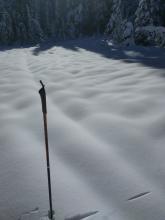
11/17/2017 - 12:28 Snowpack Observation |
Incline Lake Mount Rose Area |
 |
Public |
|
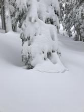
11/17/2017 - 12:00 Snowpack Observation |
Andesite Ridge Donner Summit Area |
 |
Public |
|
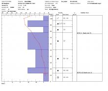
11/17/2017 - 12:00 Snowpack Observation |
Tamarack Peak Mount Rose Area |
   |
Forecaster |


This website is owned and maintained by the non-profit arm of the Sierra Avalanche Center. Some of the content is updated by the USDA avalanche forecasters including the forecasts and some observational data. The USDA is not responsible for any advertising, fund-raising events/information, or sponsorship information, or other content not related to the forecasts and the data pertaining to the forecasts.

