In partnership with: 
| Date and time of observation or avalanche occurrence | Location | Media | Observation made by |
|---|---|---|---|
|
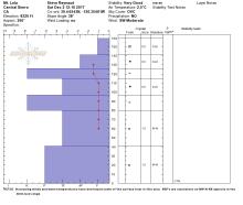
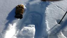
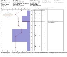
12/02/2017 - 12:00 Snowpack Observation |
Andesite Peak Donner Summit Area |
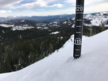  |
Guide Alpenglow Expeditio |
|
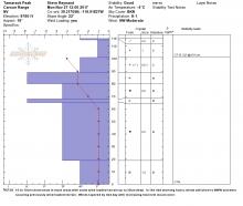
12/02/2017 - 12:00 Snowpack Observation |
Mt. Lola Independence Lake Area |
   |
Forecaster |
|
12/01/2017 - 12:00 Snowpack Observation |
Tamarack Peak Mount Rose Area |
  |
Forecaster |
|
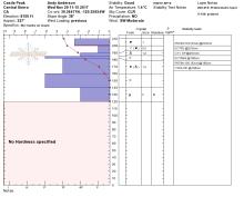
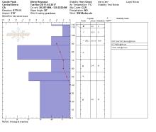
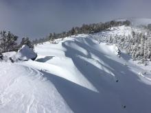
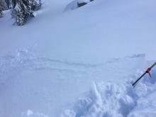
12/01/2017 - 11:00 Snowpack Observation |
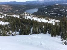
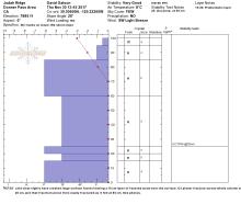
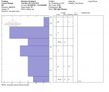
Carson Pass Carson Pass Area |
   |
Professional Observer |
|
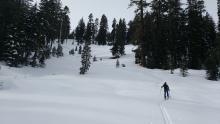
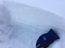
11/30/2017 - 13:45 Snowpack Observation |
Judah Ridge just below reflector towers near treeline Donner Summit Area |
    |
Public |
|
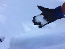
11/30/2017 - 11:00 Snowpack Observation |
Tamarack Peak and Fireplug Mount Rose Area |
 |
Forecaster |
|
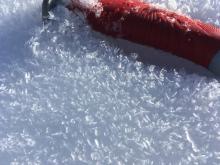
11/29/2017 - 12:45 Snowpack Observation |
Rubicon Peak West Shore Area |
  |
Forecaster |
|
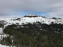
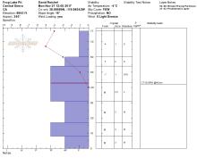
11/29/2017 - 12:00 Snowpack Observation |
Castle Peak Donner Summit Area |
 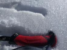    |
Forecaster |
|
11/28/2017 - 13:30 Snowpack Observation |
Roller Pass Donner Summit Area |
 |
Public |
|
11/28/2017 - 11:45 Snowpack Observation |
Castle Peak Donner Summit Area |
  |
Forecaster |
|
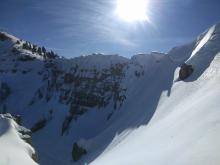
11/28/2017 - 07:22 Avalanche Observation |
Incline Peak Mount Rose Area |
 |
Public |
|
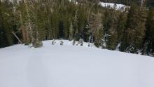
11/27/2017 - 12:00 Snowpack Observation |
Tamarack Peak Mount Rose Area |
   |
Forecaster |
|
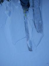
11/27/2017 - 12:00 Avalanche Observation |
Shoulder of Elephant Back above large shelf Carson Pass Area |
   |
Public |
|
11/27/2017 - 12:00 Snowpack Observation |
Frog Lake Carson Pass Area |
   |
Professional Observer |
|
11/26/2017 - 14:23 Snowpack Observation |
Grouse rock Blackwood Canyon or Ward Canyon Area |
Public |


This website is owned and maintained by the non-profit arm of the Sierra Avalanche Center. Some of the content is updated by the USDA avalanche forecasters including the forecasts and some observational data. The USDA is not responsible for any advertising, fund-raising events/information, or sponsorship information, or other content not related to the forecasts and the data pertaining to the forecasts.

