In partnership with: 
| Date and time of observation or avalanche occurrence | Location | Media | Observation made by |
|---|---|---|---|
|
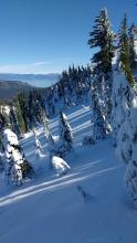
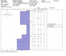
11/11/2017 - 09:40 Snowpack Observation |
SE Andesite Peak Donner Summit Area |
  |
Public |
|
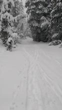
11/10/2017 - 13:00 Snowpack Observation |
Andesite Peak Donner Summit Area |
 |
Public |
|
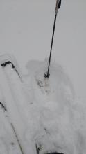
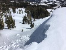
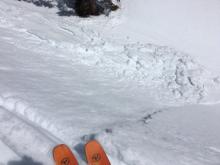
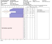
11/09/2017 - 12:00 Snowpack Observation |
Castle Peak Donner Summit Area |
   |
Forecaster |
|
11/08/2017 - 11:15 Snowpack Observation |
Lincoln Ridge Yuba Pass Area |
    |
Forecaster |
|
11/07/2017 - 11:30 Snowpack Observation |
Barker Peak Blackwood Canyon or Ward Canyon Area |
   |
Forecaster |
|
11/04/2017 - 11:00 Snowpack Observation |
Castle Pass/Andesite Ridge Donner Summit Area |
    |
Forecaster |
|
11/03/2017 - 11:00 Snowpack Observation |
East Ridge of Relay Pk Mount Rose Area |
   |
Forecaster |
|
10/30/2017 - 12:00 Snowpack Observation |
Round Top Carson Pass Area |
 |
Forecaster |
|
05/07/2017 - 09:10 Snowpack Observation |
Tamarack Peak Mount Rose Area |
  |
Public |
|
05/05/2017 - 10:00 Snowpack Observation |
Castle Peak Donner Summit Area |
|
Forecaster |
|
04/23/2017 - 14:00 Snowpack Observation |
Castle Peak Donner Summit Area |
   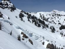 |
Guide Tahoe Mountain Scho |
|
04/23/2017 - 13:15 Snowpack Observation |
Castle Peak Donner Summit Area |
      |
Public |
|
04/23/2017 - 10:30 Avalanche Observation |
South side of Rose Mount Rose Area |
    |
Public |
|
04/22/2017 - 12:30 Avalanche Observation |
Rose Knob, Third Creek Mount Rose Area |
 |
Public |
|
04/22/2017 - 12:00 Avalanche Observation |
Lower Rose Knob Mount Rose Area |
Public |


This website is owned and maintained by the non-profit arm of the Sierra Avalanche Center. Some of the content is updated by the USDA avalanche forecasters including the forecasts and some observational data. The USDA is not responsible for any advertising, fund-raising events/information, or sponsorship information, or other content not related to the forecasts and the data pertaining to the forecasts.