In partnership with: 
| Date and time of observation or avalanche occurrence | Location | Media | Observation made by |
|---|---|---|---|
|
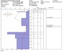
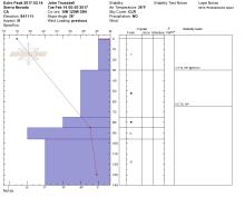
02/17/2017 - 11:00 Snowpack Observation |
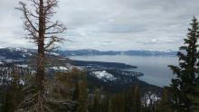
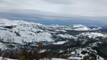
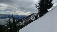
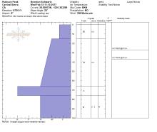
Andesite Peak Donner Summit Area |
    |
Forecaster |
|
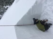
02/16/2017 - 13:17 Snowpack Observation |
1/2 way up Powderhouse Luther Pass Area (including Job and Freel) |
      ,
,
|
Public |
|
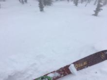
02/16/2017 - 12:00 Snowpack Observation |
Ophir Peak Mount Rose Area |
|
Forecaster |
|
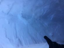
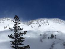
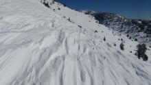
02/16/2017 - 11:30 Avalanche Observation |
Andesite Peak Donner Summit Area |
   |
Forecaster |
|
02/15/2017 - 12:00 Snowpack Observation |
Incline Lake Peak Mount Rose Area |
 |
Forecaster |
|
02/15/2017 - 11:00 Snowpack Observation |
Rubicon Peak West Shore Area |
    |
Forecaster |
|
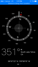
02/14/2017 - 12:50 Snowpack Observation |
Near Skin Track Below Echo Summit, Elev 8411" Echo Summit Area |
     |
Public |
|
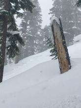
02/14/2017 - 12:45 Snowpack Observation |
Deep Creek - East Ridge Cabin Creek, Deep Creek, or Pole Creek Area |
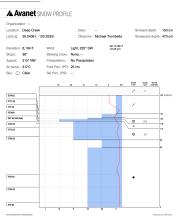 |
Public |
|
02/14/2017 - 11:00 Snowpack Observation |
Rose Knob Peak Mount Rose Area |
  |
Forecaster |
|
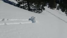
02/13/2017 - 14:23 Avalanche Observation |
Mt Rose Mount Rose Area |
 |
Public |
|
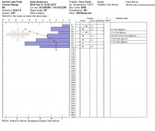
02/13/2017 - 13:00 Snowpack Observation |
Andesite Peak Donner Summit Area |
 |
Professional Observer |
|
02/13/2017 - 09:45 Snowpack Observation |
Poison Point Bear Valley Area |
  |
Forecaster |
|
02/12/2017 - 15:00 Avalanche Observation |
Desolation Wilderness Area Desolation Wilderness Area (including Emerald Bay) |
    |
Guide Tahoe Mountain Scho |
|
02/12/2017 - 14:00 Snowpack Observation |
Andesite Peak Donner Summit Area |
Guide Tahoe Mountain Scho |
|
|
02/12/2017 - 13:30 Snowpack Observation |
Apple Bonkers and Horse Canyon Bear Valley Area |
    |
Forecaster |


This website is owned and maintained by the non-profit arm of the Sierra Avalanche Center. Some of the content is updated by the USDA avalanche forecasters including the forecasts and some observational data. The USDA is not responsible for any advertising, fund-raising events/information, or sponsorship information, or other content not related to the forecasts and the data pertaining to the forecasts.